
Over the past 5 months of my training I've been having adventures all over Surrey, Sussex, the seaside and the majestic Lake District as I prepare for the epic trekking challenge which is Kilimanjaro next month - of course I'm terrified but excited at the same time!
So this training blog follows an 10 mile circular hike (which ended up being 12 miles) north of the city to Tring to follow the oldest road in Britain 'The Ridgeway' up to the Ivinghoe Beacon and back round to end in the village of Aldbury ...with my friend Nicky as a guest training buddy.
Shouldn't be too hard right?

But first some other preparations with #OneMonthToGo....
First its the 'D' word, well Drugs and Diamox - not much of a pill-taker myself, but Diamox is needed in the event of Altitude Sickness which you have to expect you'll suffer from when you ascend higher than 3,500 metres. Diamox (Acetazololamide), originally prescribed for epilepsy, is said to produce more urine and set off the bladder (so you have to pee alot!) to work the kidneys and alter the acidity in your blood, reducing fluid build up in your lungs and around your brain to prevent edema. Its worth getting some and taking with you but you're advised to do a ground trial before you hit the mountain to see how you react to them.
On half a pill twice a day, common symptoms are pins and needles, increased urinating, some nausea, fatigue and drowsiness but what you don't want is headaches, fatigue, shortness of breath, irritation and confusion - you just can't take them if you react in this way as these are signs of acute Altitude Sickness. Fortunately I only really had the common side affects to Diamox and you need to drink alot of fluids whilst taking them so you don't get dehydrated!
So much to think about but they'll be going in my bag!

I've just also completed my 67th gym (I'm know, I'm obsessively dedicated to this) session at The Gym Group who have been really friendly and supportive towards my climb - and not sick of me yet having been in the gym four times a week sweating away in my darth vadar mask hogging the steppers!


In fact I think my work jeans are splitting because my leg muscles are getting bigger! haha!

Ivinghoe Beacon 10 Mile Circular
 So beginning the hike at 11am, Nicky and I started from Tring station up in the Chilterns, with the intention of following the Chilterns Map and the navigation direction. The weekend we'd chosen to go was one of the hottest days of the year over a sizzling 30 degrees with no danger of getting cold or rain, but I made sure I had 3 litres of water on board as we set off across the sun bleached hills and the burning summer breeze following the famous 'Ridgeway' National trail up to Ivinghoe Beacon.
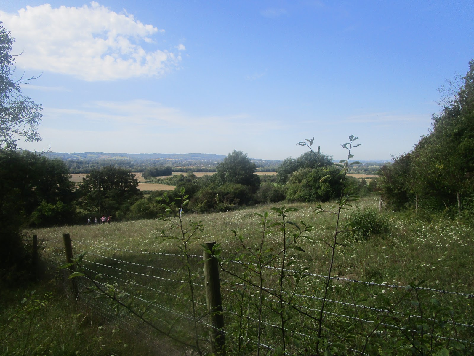
Heading along the Ridgeway and into the Aldbury Nowers Nature Reserve with fluttering butterflies on colourful wings following our footsteps - its said to contain many grass chalkland flowers and if you're walking through here on warm summer evenings you might have a chance in seeing glow worms.

The Southern plains of the Chilterns through the beech wood forest


Making our way onto the open grassy hillside of Pitstone Hill we blindly kept following the Ridgeway route up to the top of the grassy ridge on route to Ivinghoe Beacon. Straight forward enough right?


The Chilterns? or could we be on the African plains of Tanzania???

Unbelievable isn't it? how sun bleached and dry the Chiltern Hills are? You can see the little black cylinder of Pitstone Windmill on the left down in the valley

Looking south towards the Chiltern town of Ivinghoe

Looking north ahead to the start of The Ridgeway National Trail at Ivinghoe Beacon Hill in the distance or the eastern trailhead as its also known - we'll get there!

Looking back as we descend on The Ridgeway at how far we'd come..
The Ridgeway then began to climb steeply up to the south side of Incombe Hole up to Steps Hill where Nicky and I fancied going off-piste through the thorns, nettles and shrubbery to take on the temptation of the steepest part of the hill -- well it was more me that pushed it! This is what I've found myself doing on the hikes, seeking out the steepest hills to challenge myself.


Up we go!

And challenge Nicky too....trooper

But check out the view from the top! all the grazes, thorn scratches and annoying biddy-biddy's - at least I was wearing leggings despite the 30 degree heat!

And Nicky is rewarded by indulging in her love of blackberries, she'll need to bring a tupperware box next time....
Fast forward into the the future there would be a lot of 'off piste' moments on the hike which would no longer be on purpose. This would be our first -- after getting a bit confused with which peak was actually Ivinghoe Beacon, we were pointed in the right direction by friendly locals that we actually hadn't reached Beacon Hill yet and still had a bit of a way further. I think we had thought we were making good time but no...not quite, we'd still had a way to go to the start of the Chilterns section of The Ridgeway and found ourselves emerging from the woods and back on track towards Beacon Hill...

Almost there! and perplexed how someone isn't missing their car keys in a car park?

So we followed the Beacon Walk through the yellow chalk fields smoothing themselves over the Chilterns, petting dogs and meeting a lady who's friend actually suffers from M.E, we finally came to the flagstone of Ivinghoe Beacon making us feel super empowered but also sheepish we thought we'd nailed it a little too prematurely ;/ whoops!
The ancient 5,000 year old 'Ridgeway' actually starts in either Avebury in Wiltshire or Ivinghoe Beacon and crosses through the chalk ridges of the Chilterns all the way down through North Wessex Downs to Berkshire or all the way up towards us (depending which way you look at it) - a pretty long track either way at 140km or 87 miles!

Wahooh! Part One done, we finally made it up to 233 metres to the summit of Ivinghoe Beacon looking over Dunstable Downs, the hills above Tring all everything else in between!

With this newly found confidence, believing we could follow the rest of the way no problem -- we began trotting off to the east following our map over the worn parched footpath sunken into the undulating hills towards Whipsnade - home of the famous British zoo, quizzing a passing man with very professional photography kit over his birdwatching activities (I mean winged birds, not the other kind) as he pointed out migrating little whinchat birds squabbling in the nearby shrubbery.

The great 'White Lion' of Whipsnade Zoo cut into the chalky hillside is 147 metres long you know!

Okay, so on we plodded in the scorching heat with the bare sun beating down on us passing by the chalk grazed fields which gave off an almost saharan feel!

We continued following the map and 'well marked paths' following fence lines and across open fields and ridges where we were looking fo the boundary trail to head us east to the village of Ringshall. This is where we, well....got a bit distracted and 'off piste' by the bounding fluffy balls which were a rumbling herd of sheep bleeting and running down the hill to quench their thirst in the water tank.

Bunch of cuties.....
The sheep led us astray and our navigation blipped as we continued straight up the hill to the bombshell realisation of arriving back at the Beacon Hill car park again! Arghhh! We'd walked around in a circle. Ditching the idea of following the map, we asked local passerby's for the right track and got the classic 'it's in that direction, head that way' leading us off going up the same hill twice and to dead ends of chalk fields, seeking shade under the umbrella of the trees as we try to figure out how to get out from the draining exposure of the open fields and into the forest to join the Boundary Trail.
One simple turn was what we missed and it took three attempts to find it! Our self navigation skills were proving a little bit trying up here in the Chilterns but a glimmer of luck caught our attention when a left turn escaped us and we sussed out our track in to the woods onto the Boundary Trail.
Never an adventure if it goes alright....right?

Shade - thank god!
Now heading East towards Ringshall, we were glad to be in the cool shade of the forest as our water supply was depleting from our goose chase to found ourselves here - note to yourselves, be wary of arrows you're following in the woods that they are the right ones, we ended up taking the wrong turn again doing a big detour up the same flight of stairs (poor Nicky, putting her through it!!) I actually welcomed the extra practice! But we set ourselves back right again in the wooded labrinth past a closely planted conifer plantation and up onto a steep sided ridge.

Once we finally emerged from the woods, finally, from the woods.....it opened out onto a farm. A classic farmyard, with a pond in the middle with bathing ducks and a real authentic farmery tractor and barns and manure and everything else....including a strange graveyard for banger cars but that's what the surprise of explorations are for right?
Nicky and I decided to resort back to the written directions to stay on track passing over several fields of ruffled sheep and over grassy mounds and though numerous gates, sticking to the directions served us well and we broke out back into civilisation to the village of Ringshall. We were going the right way, hallelujah!!

The honeyed sunlight spotlighting the mansion house was like a landmark of achievement! So we hadn't been completely hopeless navigating ourselves through the Chilterns.

Part Three of the hike, we needed to start heading south towards the Chiltern Way and towards Aldbury Village when the map really wasn't making much sense anymore and it was Nicky's turn to be navigator. After some km's stomping through more shady wooded forests of squabbling squirrels, we got on to The Chiltern Way which should lead us all the way to Aldbury looking over very swanky houses with HUGE manicured gardens until we came out to here....

The open greens of a Golf course....
We had stumbled onto the Ashridge Golf Club complete with grazing fallow deer....well maybe not stumbled, but the Chiltern Way involved us having to cross the greens (we thought it was pretty strange to have a public footpath across a private golf club anyhow, where golfer were given us strange looks as if we shouldn't be there). And we would have given us strange looks aswell as the directions where so confusing, we ended up wandering around the course being shouted at to 'get off the green!'. Exhausting all our ideas, we attempted to seek help from one golfer who proved to be not that helpful because he 'couldn't see the map because he didn't have his glasses on'....yet he was playing golf....mmmm.
Anyway, Nicky had the idea of asking in the clubhouse so precarious to intrude our muddy boots into the pristine golf club, a friendly waiter had a good idea of where we should be heading, adding an extra piece of direction missing from our map and sent us on our way strangely across the green into the woods (we were pretty confident others would have got lost following these directions to make us feel better about our third navigation blunder of the day).

Anyway Part Three, getting away from the golf course we travelled a while longer, being mindful that the sun was setting and we had to pick up the pace for our lost time, passing through Aldbury Common, along tarmac roads, bridleways more slopes, more squirrels, barns, houses, more squirrels, down slopes until we hit the Icknield Way and then the Chiltern Way again and wow, that's a lot of 'ways' to follow up in the Chilterns!

Aha and phew! we finally reach the edge of the village of Aldbury before sunset bringing us out onto a field of the smartest vegetable allotments we'd seen with pumpkins the size of footballs and friendly gardeners tending to them - and a children's playground right in the middle of them....


Tadaa! we made it to Aldbury Village! and the little post office, nestled in the village green. We had made 9 miles of the loop (although we probably added a couple of extra miles from all our detours) to finish at the little village - which fun fact, has often been used for Film and TV in the likes of Midsomer Murders, James Bond and the Avengers to name a few.
And so Nicky and I were relieved at least that we hadn't got to the point where we would have had to get our mobile phone lights out and try and found our way off the loop in the dark, even though we did consider the likelihood of it as the sun began dipping quickly!
Albury Village is well worth a little stroll if you're up in the Tring area with its picturesque old tudor style buildings and complete with a large pond and would you believe....some stocks!

Some stocks in the village? popular in the middle and high medieval times, we couldn't resist a little fun where I tried to put my head through the holes to feign humiliation without much success.

We then realised in horror the sign next to it reading 'Ancient Monument, Do Not Touch' eeep! and we scarpered! Can you imagine the humiliation if I had really got my head stuck!

And so our microadventure came to an end relatively unscathed as we vamoosed out of Albury and headed back to Tring across the beautiful summer dusk soaked fields and cool inky air.
Thanks for reading folks and if you'd like to support me on my Kilimanjaro climb in 5 weeks time, I'd really appreciate any kind donation you could offer to my Just Giving page - with all the proceeds going to Action For M.E who help my sister cope with living with Chronic Fatigue Syndrome.
Till the next training adventure...
Peace
Training Walk Distance: 19 Km (12 Miles) aboutish.....

No comments:
Post a Comment
Scribble back!